|
Bahamas 2022 Main Page
Leg 0 - Getting Started
Leg 1 - The Chesapeake Bay
Leg 2 - The Intracoastal Waterway
Leg 3 - The Bahamas
Leg 4 - Homeward Bound
Expenses
Synchronicity Main Page
Progress Map
Bahamas Map
Most Recent Post
|
|
5/9/23
26°42'05.0"N
78°59'29.4"W
St Augustine Municipal Marina
St Augustine, FL
Start: Monday May 8 11:00am
Arrive: Tuesday May 9 8:00pm
Miles:
Total Miles:
Go to Top
|
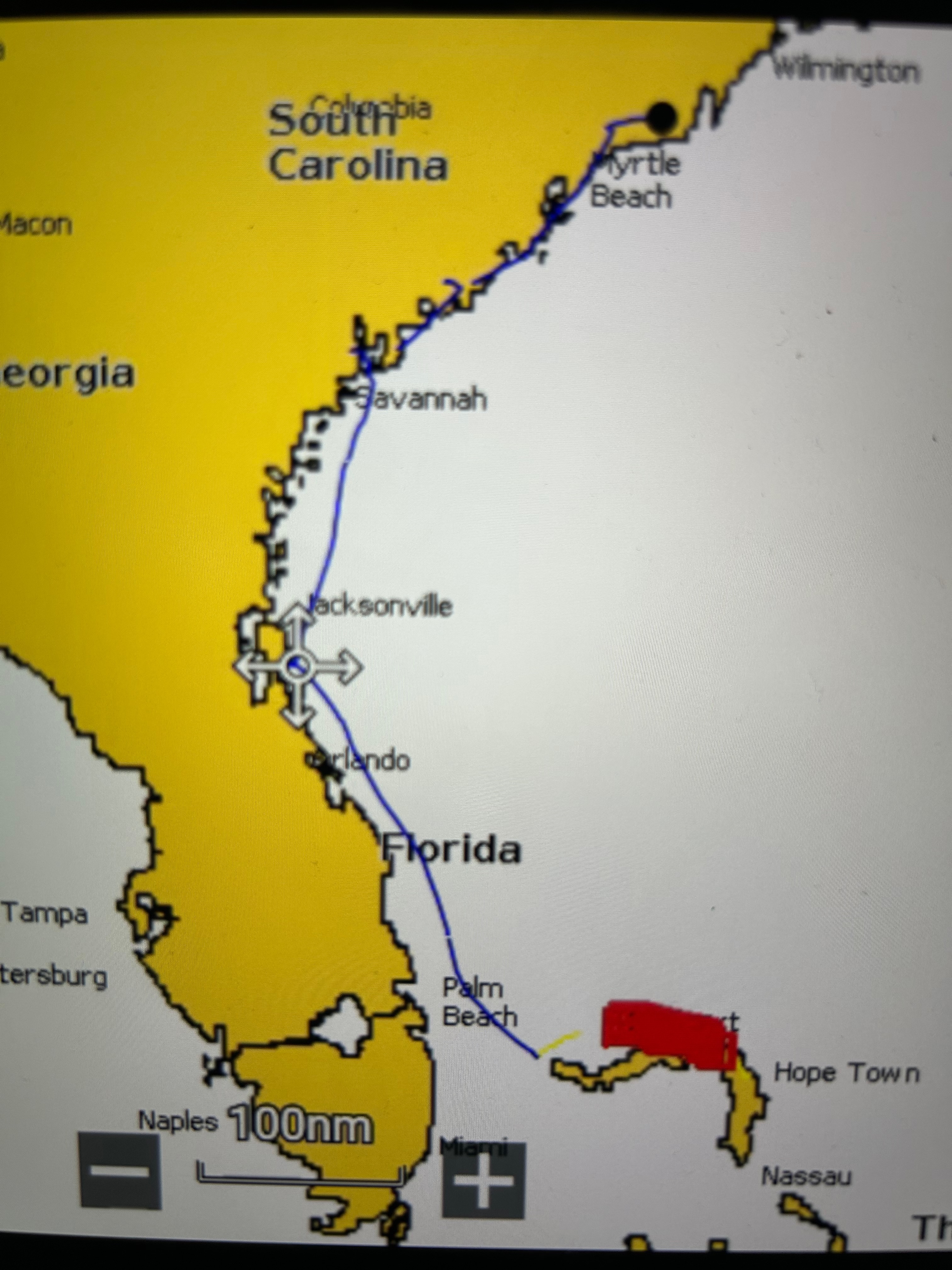
After an abbreviated stay in the Bahamas, and a lengthy weather delay at West End in the Bahamas, we finally got across the
Gulf stream and made it to St. Augustine, FL. A trip of 21 hours.
|
|
5/13/23
29°53'31.5"N
81°18'32.2"W
Skull Creek Marina
Hilton Head Island, SC.
Start: Friday, May 12 9:30am
Arrive: Saturday May 13 1:30pm
Miles:
Total Miles:
Go to Top
|
Another overnight run to Skull Creek at Hilton Head Island.
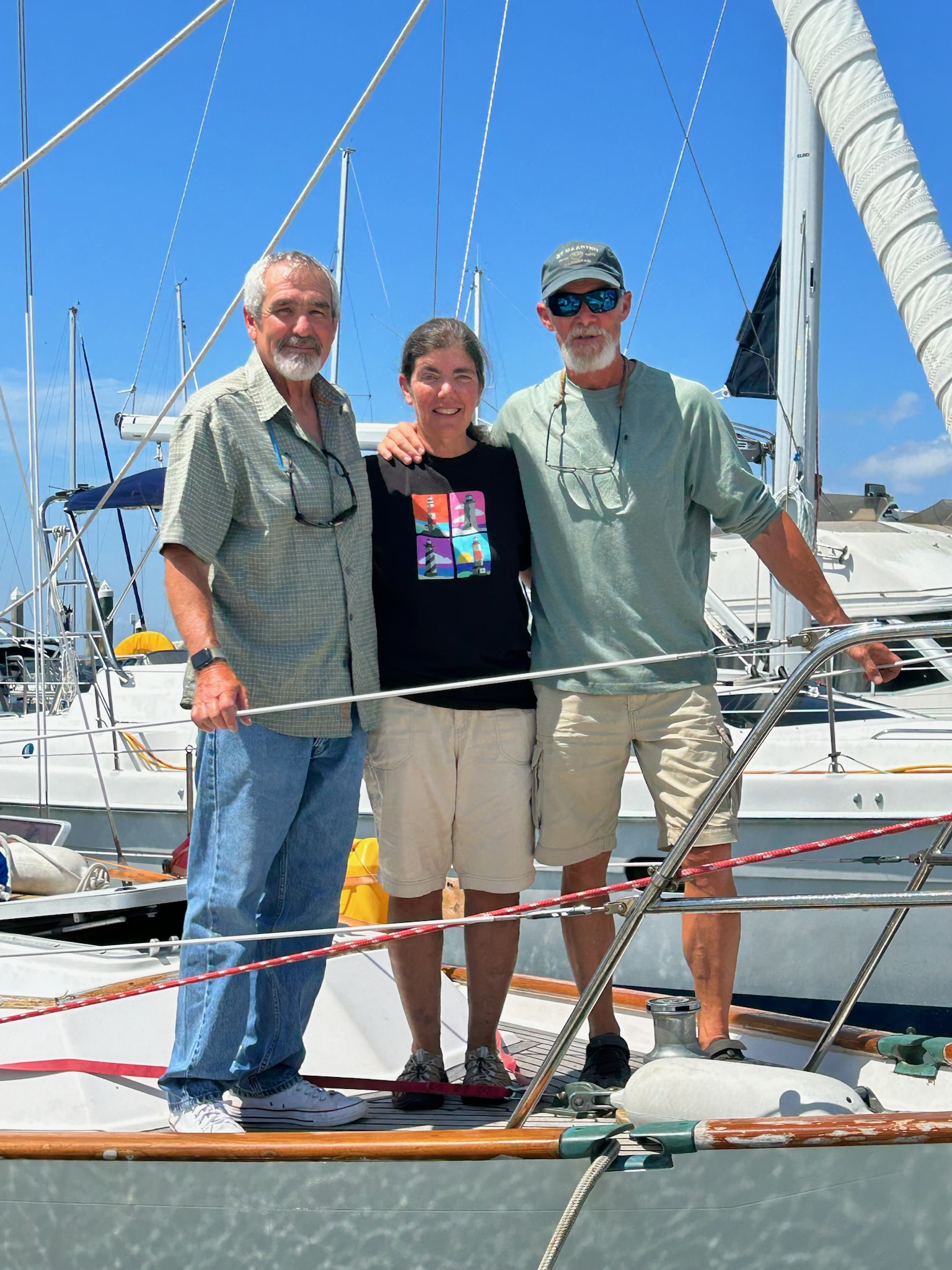
Saying Goodbye to Kevin at Skull Creek.
|
|
5/16/23
32°46'38.2"N
79°57'07.3"W
Charleston City Marina
Charleston, SC.
Start: Friday, May 16 9:30am
Arrive: Friday May 16 7:30pm
Miles: 78.1
Total Miles:
Go to Top
|
A daytime run Charleston - .78 miles. It was nice to be tied up to a dock before dark...
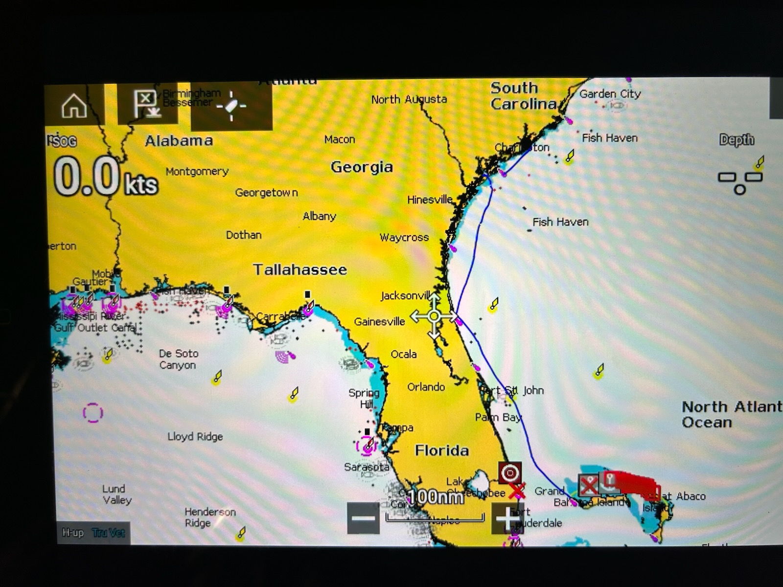
The blue line is the GPS track since we left West End in the Bahamas.
|
|
5/17/23
32°47.220'N
79°54.555'W
Charleston Harbor Resort and Marina
Charleston, SC.
Start: Wednesday, May 17 12:30am
Arrive: Saturday May 17 1:30pm
Miles: 3.74
Total Miles:
Go to Top
|
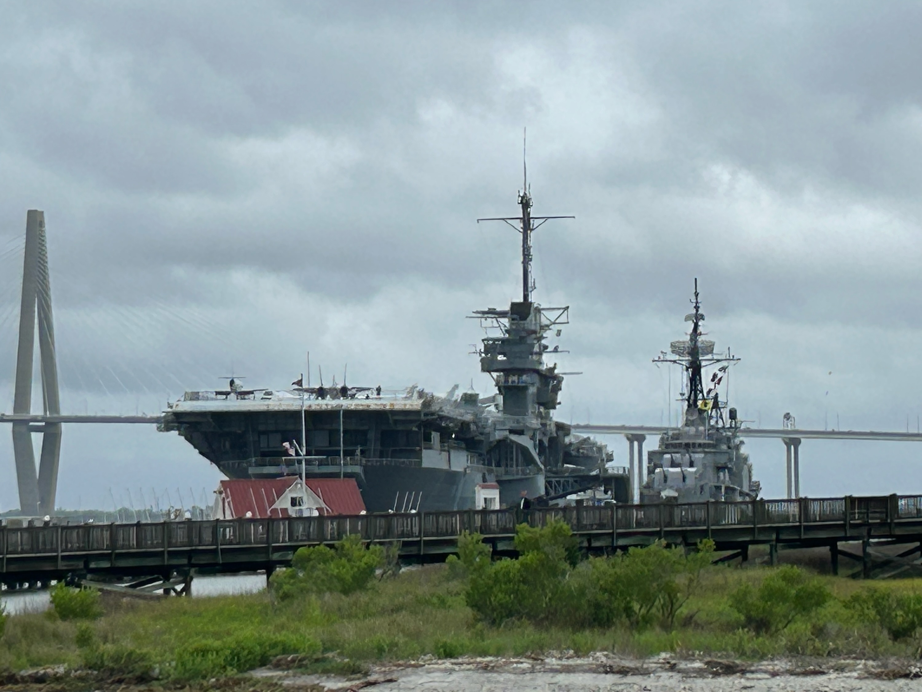
Had to leave the City Marina as they were booked solid for days. Went to the Charleston Harbor Resort and Marina, as
it was the only marina that was not full. We are in the shadow of the aircraft carrier/museum Yorktown. We went
aboard to take a tour - it was pretty impressive.
|
|
5/21/23
35°51'12.6 N
78°32'42.9 W
Little River Inlet Anchorage
Little River, SC.
Start: Saturday, May 20 3:00pm
Arrive: Sunday May 21 9:00am
Miles: 102
Total Miles:
Go to Top
|
Never a dull moment on the ICW. Turns out that there is a big Fishing Tournament in Georgetown, SC in a week or so
and all of the marinas are filling up and the anchorages are filling up as well. This leaves us with no place on the ICW
to stop for the night. So we decided to leapfrog the whole mess and go outside on the Atlantic. Did an 18 hour overnight
run to an anchorage just off the inlet. Easy run light winds and almost no waves, only 1 to 2 foot swells.
But Little River Inlet is one of those out of the way inlets that get rearranged every time there is a big storm. It
is reasonably deep, but with current and a torturous channel snaking through. Entering a strange inlet is always a
stressful time for me. Inlets can be treacherous for the unwary. I had even called TowBoatUS the previous day to
check on conditions and one their captains said it was straightforward, the markers were accurate and well placed and
the channel deep.
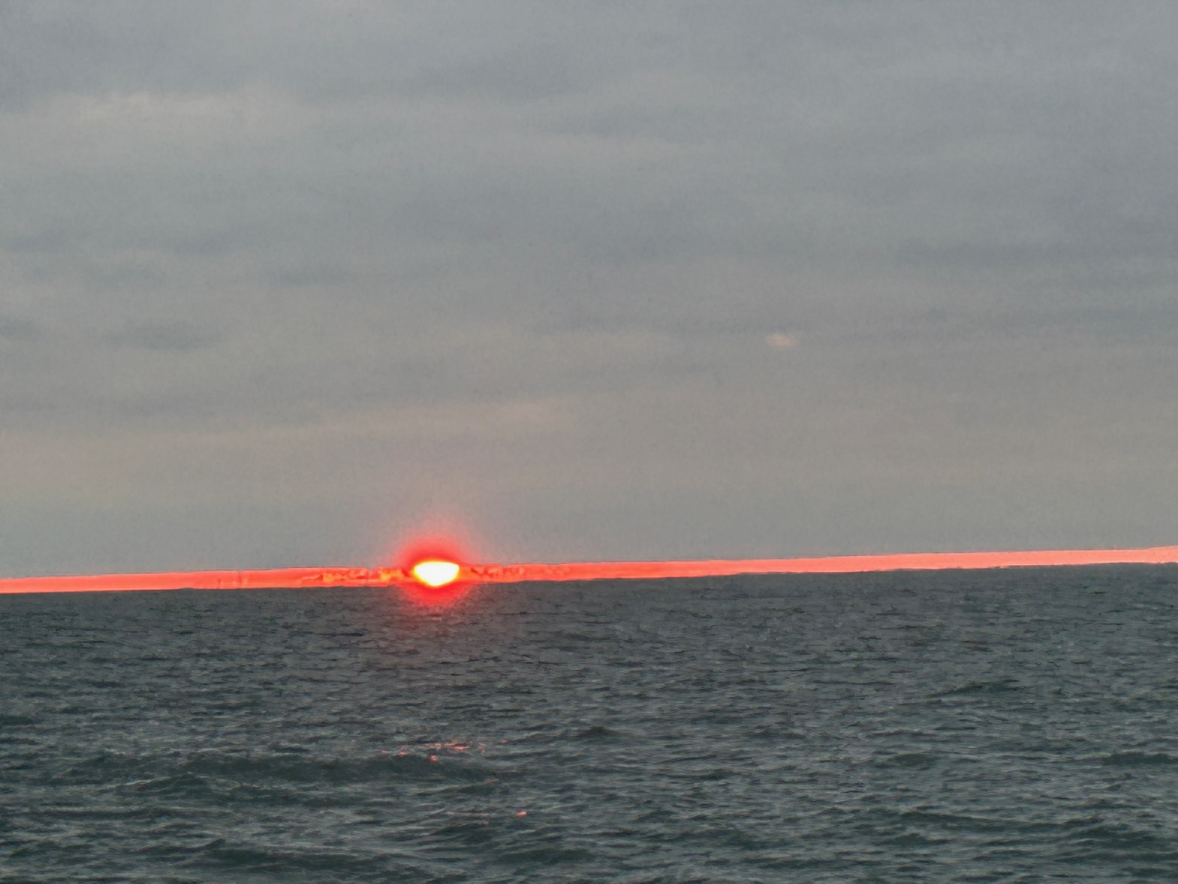
A weird looking, upside down sunset caused by a narrow gap
between the clouds on the horizon and horizon itself.
|
|
5/21/23
35°51'12.6 N
78°32'42.9 W
St James Marina,
Southport, SC
Start: Sunday, May 21 12:30pm
Arrive: Sunday May 21 5:30pm
Miles: 25.4
Total Miles:
Go to Top
|
We reached the Little River Inlet, but we were not comfortable with the Anchorage. We had planned for an option
to continue on up the ICW if we got there early enough. We were early, but I was exhausted and would have very much
liked to stay there for the night, but it just did not feel secure. We waited out some mild rain and continued on after
a short rest. It was a tough ride - 24 hours with no sleep (18 of them underway) - I was beat and motoring up the ICW
with a current running against me. A VERY long 5 hours after I thought we could stop and anchor for the night at the
inlet anchorage...
Homeward Progress to date.
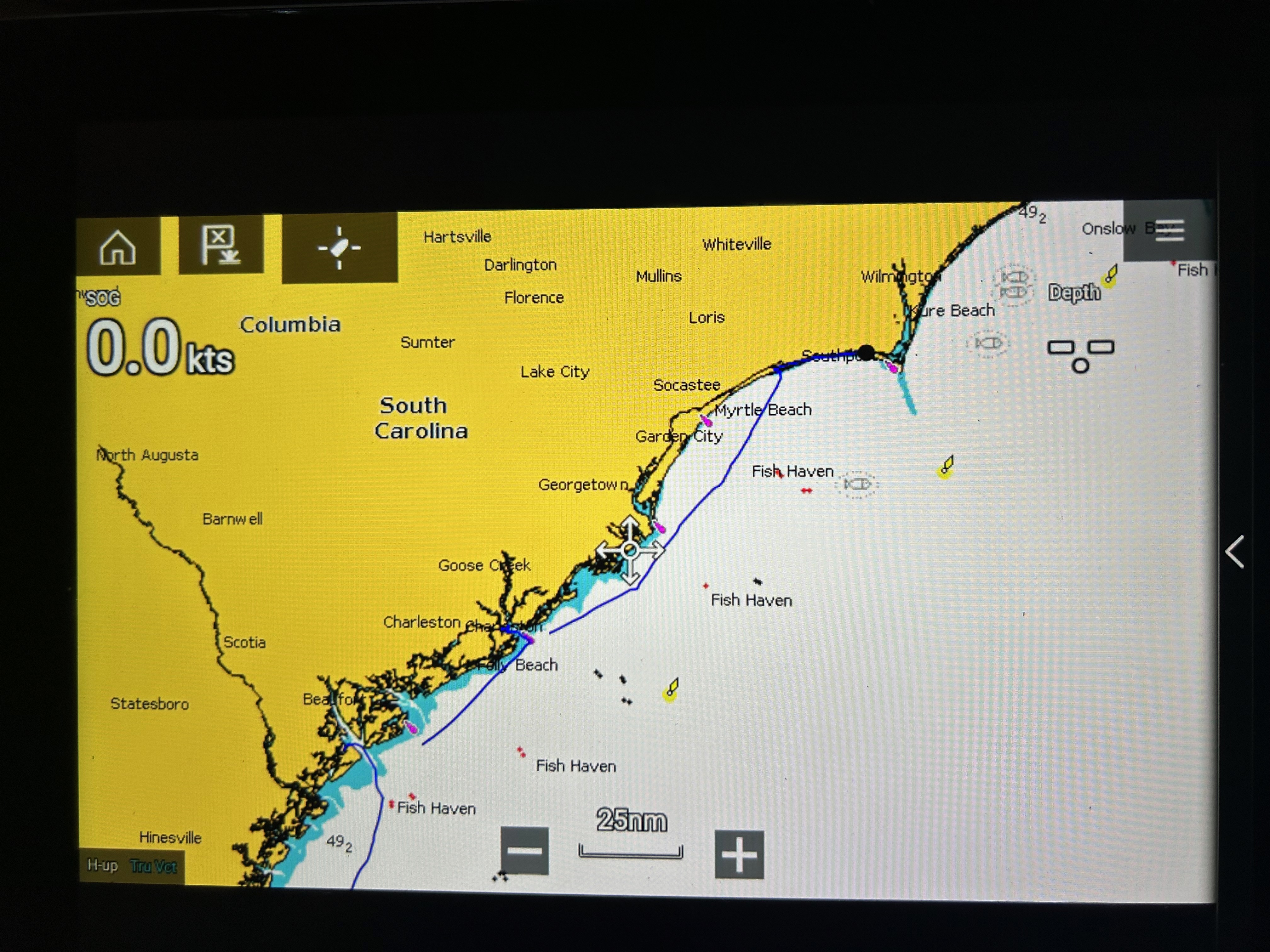
Detail of the Georgia and South Carolina coastal runs.
|
|
5/24/23
33°55'50.6" N
77°59'48.2" W
Deep Point Marina,
Southport, NC
Start: 9:30am
Arrive: 11:30am
Miles: 7.1
Total Miles:
Go to Top
|
Had a rough ride up the Cape Fear River. My anchor was ripped off the bow by a wave and went overboard, wrapping around the
boat in the process. Had to get towed to a nearby marina. Then had to wait out a few days of miserable weather.
|
|
5/29/23
34°12'21.7" N
77°47'59.9 W
Wrightsville Beach,
Southport, NC
Start: Tuesday, May 29
Arrive: Tuesday May 29
Miles:
Total Miles:
Go to Top
|
On the road again. The run of bad weather ended early so I wanted to make some northward progress before docking the boat
for a few days and driving up to Virginia to see a show and hang out with my friends. Going to head to Beaufort, NC now and
drive up from there, and returning here to finish the trip.
|
5/30/23
34°33'06.8" N
77°19'31.8 W
Mile Hammock Bay,
Camp Lejeune, NC
Start: 8:15am
Arrive: 5:00pm
Miles:
Total Miles:
Go to Top
|
This is a frequent stop for me on these trips. Just an anchorage on the grounds of Camp Lejeune in a convenient location.
|
|
5/31/23
34°42'55.2" N
76°39'50.1 W
Beaufort Docks,
Southport, NC
Start: 9:30am
Arrive: 6:00pm
Miles: 39.09
Total Miles:
Go to Top
|
At the City Dock in Beaufort, NC now and returning here to finish the trip. Drove up to Virginia on 6/2 to see a show and hang
out with my friends. Returned on Sunday 6/4.
|
|
6/5/23
34°42'55.2" N
76°39'50.1 W
Oriental Marina,
Oriental, NC
Start: 12:15pm
Arrive: 6:00pm
Miles: 24.36
Total Miles:
Go to Top
|
Had current in my face all day slowing me down to under 5 knots. Long day for such a short trip.
|
|
6/6/23
34°42'55.2" N
76°39'50.1 W
Dowry Creek Marina,
Belhaven, NC
Start: 8:15am
Arrive: 5:15pm
Miles: 24.36
Total Miles:
Go to Top
|
|
|
6/8/23
34°42'55.2" N
76°39'50.1 W
Coinjock Marina,
Coinjock, NC
Start: 6:30am
Arrive: 7:00pm
Miles: 72.88
Total Miles:
Go to Top
|
Very long day... Get a lift from the current in the Alligator River - Pungo River canal. And I actually saw a large
Alligator swimming across the canal.
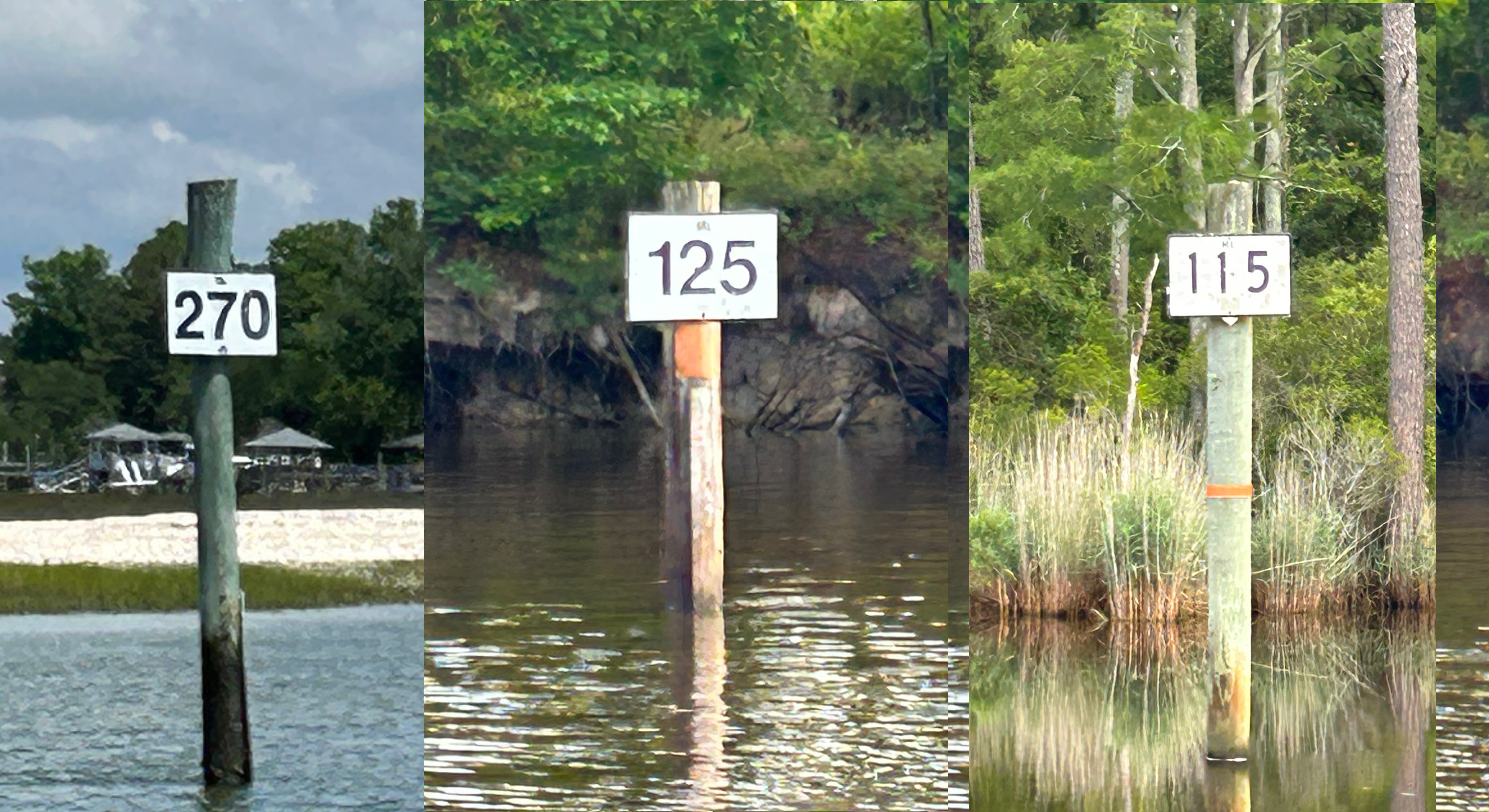
On the way home on the ICW the mile markers take on new meaning. They indicate the distance (in statute miles) along the
ICW to Mile 0 at Norfolk, VA. This is the mouth of the Chesapeake Bay, which I consider my home waters. So every time I
pass one of these markers I know just how far I have to go to get to the Bay and the doorstep to home.
|
|
6/9/23
37°01'28.1" N
76°20'27.1 W
The Docks at Hampton,
Hampton, VA
Start: 8:30am
Arrive: 8:30pm
Miles: 56.01
Total Miles:
Go to Top
|
I was racing the sun to get to Hampton before sunset. Despite delays at the Great Bridge Lock, the sun only beat me by 1/2 mile.
But it was still light when I got here. I could not have transited Norfolk in the dark...
But at this point I am done with the Intracoastal Waterway. It's all Chesapeake Bay from here.
|
|
6/10/23
37°01'28.1" N
76°20'27.1 W
Fishing Bay Anchorage,
Deltaville, VA
Start: 8:15am
Arrive: 8:30pm
Miles: 56.01
Total Miles:
Go to Top
|
I like this anchorage - it is conveniently located and I stop here every time I go south.
|
|
6/11/23
38°19'47.1" N
76°27'01.2 W
Mill Creek Anchorage,
Solomons, MD
Start: 8:30am
Arrive: 7:30pm
Miles: 63.01
Total Miles:
Go to Top
|
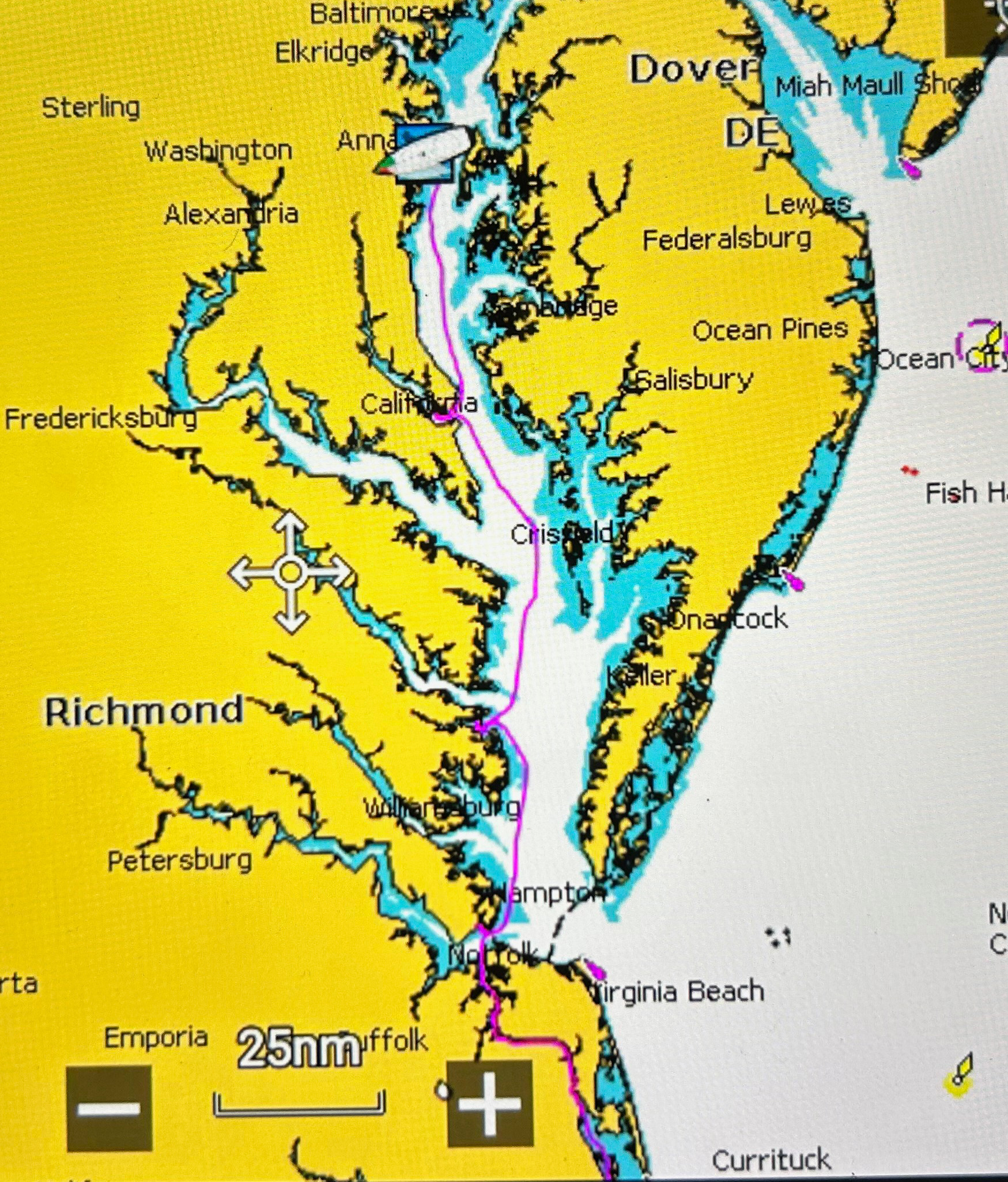
A long, fairly rough ride across the confluence of the Potomac River and the Chesapeake Bay - aka the 'Mixing Bowl'. Stayed an extra
night here to miss the rain.
|
|
6/13/23
38°19'47.1" N
76°27'01.2 W
Annapolis Harbor Mooring,
Annapolis, MD
Start: 9:15am
Arrive: 4:40pm
Miles: 45.35
Total Miles:
Go to Top
|
The trip is complete.
6 months, 27 days, 6 hours and 25 minutes.
I'm home...
The Chesapeake Legs
[NOTE: I will be filling in some of the blanks and adding pics as I get the time and inclination to work on it. More still
to come...]
|
.


